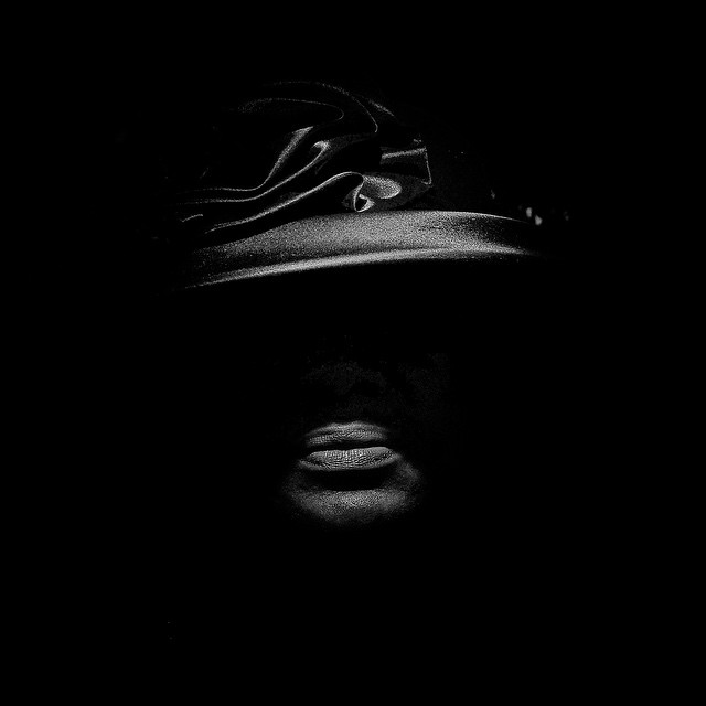
MATTBLACK_BLACKMATT #1
Farmworker camp. Alpaugh, CA.
MATTBLACK_BLACKMATT #2
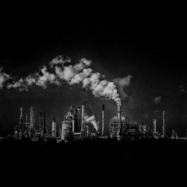
The Geography of Poverty USA - Cancer Alley, Louisiana. Cancer Alley is an 85 mile stretch of over 200 petrochemical facilities beginning in Baton Rouge (25.4% poverty) stretching past New Orleans (27.3% poverty) and towards the coast. Though comprising just 1/3 of the state’s population, 80% of Louisiana’s African-American residents live within three miles of a hazardous industrial zoned facility.
MATTBLACK_BLACKMATT #3-#4
#3
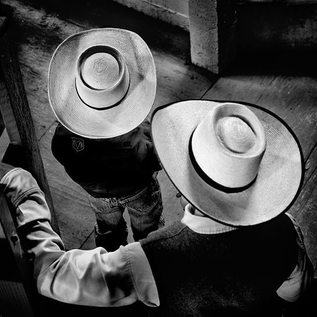
Alturas, CA. Cattle auction. Alturas has a population of 2,827 and 29.3% live below the poverty level. “They say there isn't much here for a young kid, and there isn't.”
#4
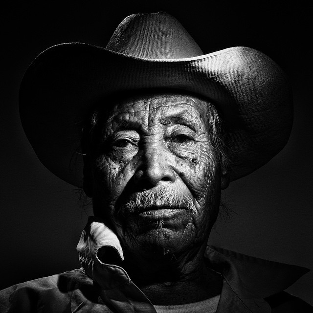
The Geography of Poverty USA - Kern County, CA. Kern County has the most active oil fracking operations in the state and the deadliest air pollution in the nation. “If one starts to get dizzy, you are going to say, ‘Would it be because of this, or that?’” says Ernesto Perez, 80. “So no one will blame the oil, but I’m sick, I’m in bad shape now. And if it is because of the oil that one gets dizzy, well, it doesn’t matter.”
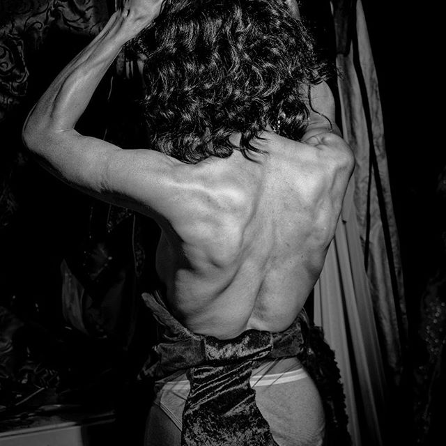
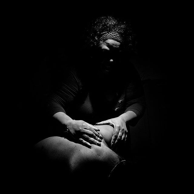
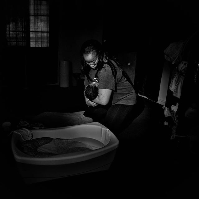
MATTBLACK_BLACKMATT #5-#6-#7
#5
Birmingham, Alabama. Preparing for a transgender ball.
#6
Chicago, IL. Chicago has a population of 2,695,598 and 22.7% live below the poverty level. A mother massages her son’s back where the bullet that entered his face became lodged, leaving him paralyzed since age 14. In Chicago so far this year, 2,703 people have been reported shot.
#7
Flint, MI. Baby's bath in a tub of bottled water. Tiantha Williams was diagnosed with listeria during her pregnancy, and her son was born two months premature. "When he came out, he wasn’t breathing,” she said. “The water caused my baby to almost die."
MATTBLACK_BLACKMATT #8
Syracuse, NY. Syracuse is a city in Onondaga County, New York. The population is 145,170 and 34.6% live below the poverty level.
MATTBLACK_BLACKMATT #9
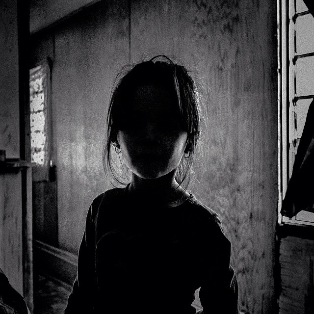
Homeless camp Fresno, CA.
MATTBLACK_BLACKMATT #10
Leaving at night. Out the dirty sheet windows of the bus, the neon bail bond signs and orange street lamps and blinking stoplights take on a muted, gauzy hue. Streets shimmer like a reverse aquarium, liquid light blurring and bending in the passing diorama, twisting the hard angles of a gritty downtown. Inside our envelope of air, we're in motion, diving again.
MATTBLACK_BLACKMATT #11
Dawn breaks outside and a pale blue light grows to fill the station window's black squares. A light rain follows. Bus is nearly full. The only window seat is in back by the toilet. An acidic blue smell dampens the air. The bus hums below and rattles above, and the spray of rainwater kicked up from the highway sizzles across the windows. The deep throb of the low- geared engine pulses across the feet, vibrates the back
MATTBLACK_BLACKMATT #12
Coos bay, OR. Salmon run Coos Bay is a city in Coos County, Oregon. The population is 15,967 and 21.2% live below the poverty level. #geographyofpoverty
MATTBLACK_BLACKMATT #13
Cleveland, OH. Cleveland is a city in Cuyahoga County, Ohio. The population is 396,815 and 35.4% live below the poverty level.
MATTBLACK_BLACKMATT #14
Baton Rouge, Louisiana. Cancer Alley: “It’s all about that cash dollar.” The petrochemical companies “try to make us feel like we’re in the wrong.” Baton Rouge is the capital of Louisiana. The population is 229,493 and 25.4% live below the poverty level.
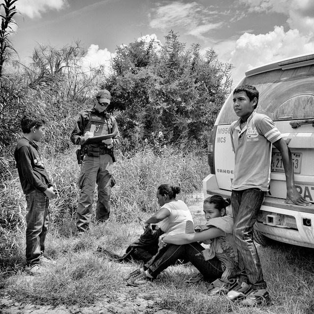
MATTBLACK_BLACKMATT #15
The Geography of Poverty USA - McAllen, TX. A family from Honduras detained at the border.
MATTBLACK_BLACKMATT #16
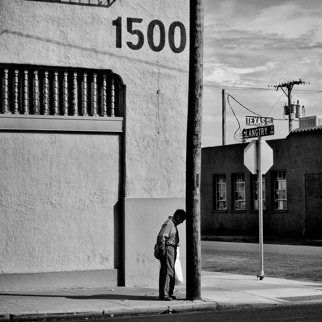
CBS Sunday Morning profiled the Geography of Poverty. Follow link in profile to view. El Paso, Texas. 2015.
MATTBLACK_BLACKMATT #17
The Geography of Poverty USA - Oil field. Bakersfield, CA. Kern County's fields produce one in every 12 barrels of domestic oil. Deep shale drilling releases into the air compounds that cause smog, respiratory problems, and cancer.
MATTBLACK_BLACKMATT #18
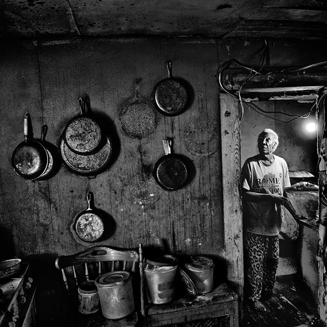
It was a pleasure talking with Weekend Edition @NPR about the Geography of Poverty. Follow link in profile to hear the interview. USA. Rome, Mississippi. 2017.
MATTBLACK_BLACKMATT #19
Up Close & Personal “When I photograph a place, I return and return again; I drive the same roads, walk the same trails, eat the same food, sleep in the same rooms. Over time, everything becomes intimate and familiar: the smell of the air, the color of the dirt, the cut of a certain shadow, even the lines in someone’s hand. I absorb it. Sometimes I can close my eyes, and I can still see it.”
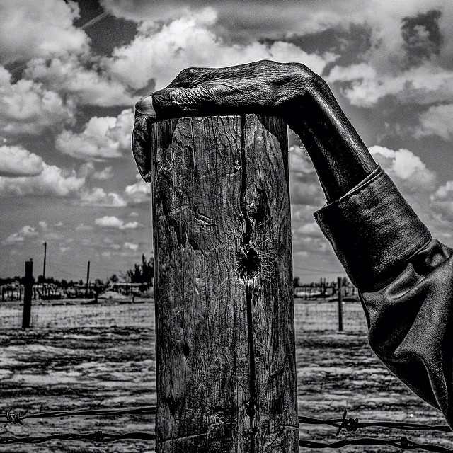
MATTBLACK_BLACKMATT #20
Eagle Butte, South Dakota. Corral on the Cheyenne River Indian Reservation. Eagle Butte has a population of 1,318 and 51.5% live below the poverty level.